Exploring your Local Area
Studying old maps is a fascinating way to find out about the past. Van Gogh House is situated at 87, Hackford Road in the borough of Lambeth, London. It is an area which has undergone huge changes over the past 200 years. Take a closer look at the maps below to find out how.
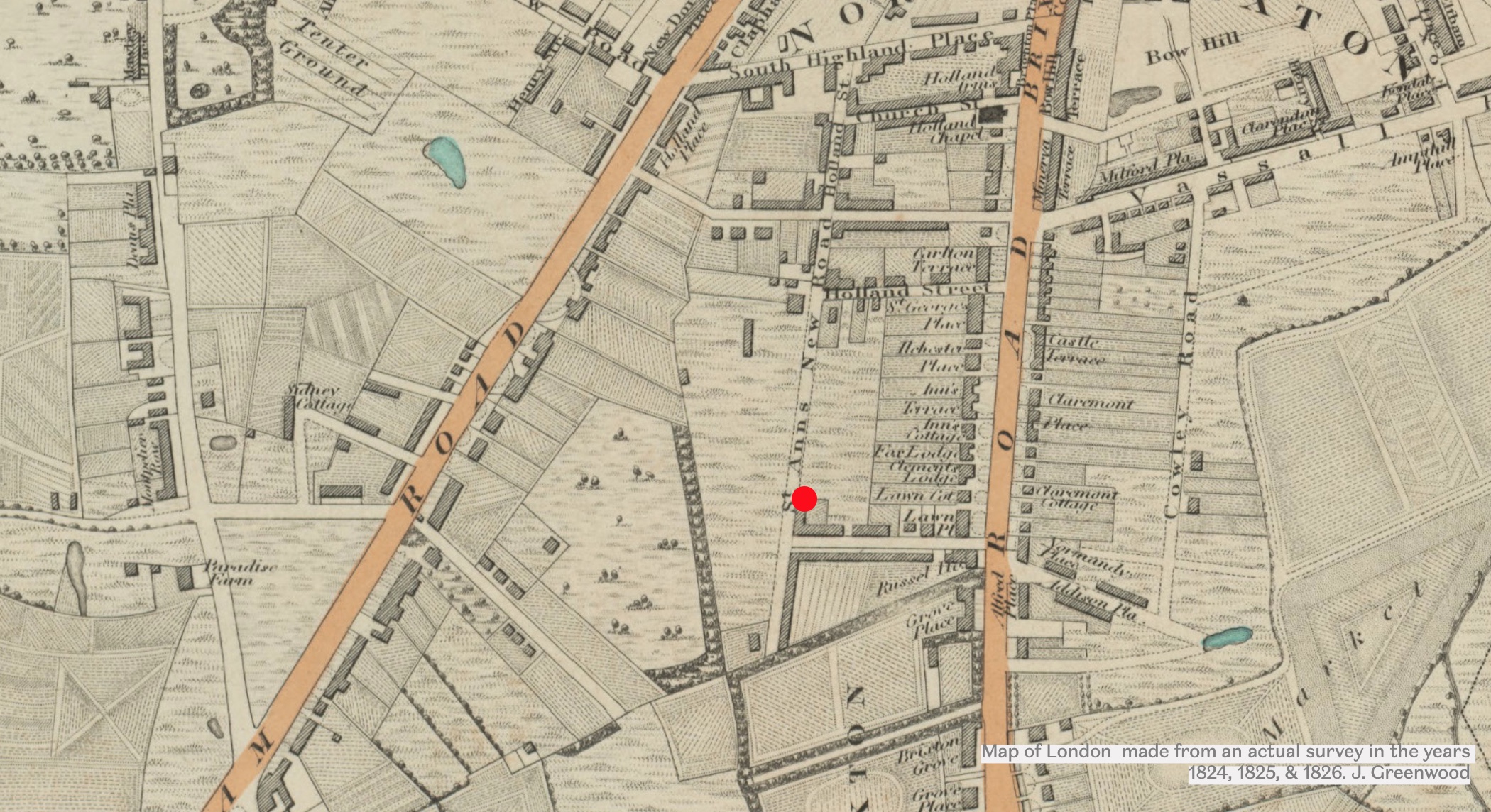
1820s
When Van Gogh arrived, the house was 50 years old. This map shows what the area looked like in 1824 when the house was built. The red dot marks the location of Van Gogh house.
-
-
Today, the house is on Hackford Road but this has changed. What was the name of the road 200 years ago?
-
This road leads to another, with a name connected to Vincent Van Gogh. What is the link?
-
Today, Van Gogh house is surrounded by streets of houses and other buildings. How would the area have been different in 1824?
-
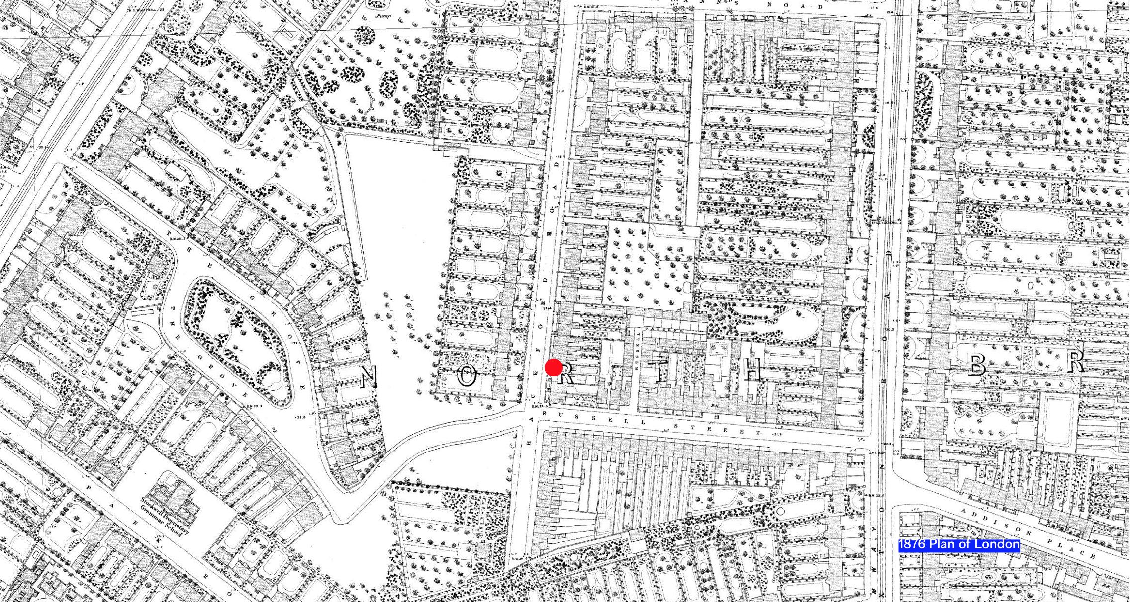
1870s
Here is a map of the same area from 1876 , a few years after Van Gogh lived in the house.
-
What does this map tell you about how the area has changed?
-
What is the road called now?
-
A home for children without families has been built. Can you see it? What is its name?
Can you find some historical maps of your local area? Try searching in your local archives which you might find on your local council website.
How has your area changed over the years? What local landmarks have remained the same?
Answers
1824 Map
-
In 1824, the road was called St Ann’s New Road
-
St Ann’s New Road leads to Holland Street. Vincent Van Gogh was from the Netherlands which is also called Holland.
-
The area was mainly fields where crops would have been grown and animals kept. There is also a market garden where fruit and vegetables would have been grown to sell to local people.
1876 Map
-
The area has changed a great deal. Many houses and new roads have been built. There are small parks and private gardens rather than fields. This area would have looked ultra-modern to a young Vincent Van Gogh. Brixton Road would have been busy with horses and carriages and with horse drawn trams going into the city.
-
The road has been re-named Hackford Road.
-
Stockwell Orphanage (at the bottom left-hand corner of the map, labelled Stockwell Proprietary Grammar School).